


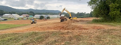
NEW CONSTRUCTION>>>>>>>>


Meadowlake Airpark (12TN) Information
12TN
LOCATION
Airport Identifier: 12TN
Airport Status: Operational
Longitude/Latitude: 084-32-19.7620W/35-49-25.2670N -84.538823/35.823685 (Estimated)
Elevation: 750 ft / TPA 1800 ft
Land: 27 Acres
From Nearest City: 3 nautical miles SW of Kingston, TN
Location: Roane County, TN
Magnetic Variation: 05W (2017)
Ownership: Private
Owner: Sammy Jones
Airpark Operations & FAcilities
Airport Use: Private
Wind Indicator: Yes
Segmented Circle: No
Control Tower: No
Lighting Schedule: SS-SR
Landing Fee Charge: No
Sectional Chart: Atlanta
Region: ASO - Southern
Airpark
Services
Fuel available: Fuel for Club members
Airframe Repair: Major and Minor, Paint
Power Plant Repair: Yes
RUNWAY INFORMATION
NOTAM
none
RUNWAY 05
Traffic Pattern: Left
2600 ft x 40 ft
Left Markings: Basic, Good Condition
No ILS, No glidescope
RUNWAY 23
Traffic Pattern: Left
2600 ft x 40 ft
Left Markings: Basic, Good Condition
Displaced threshold: None
No ILS, No glidescope
Radio Navigation aides
122.9 UNICOM
122.2 Nashville
HCH
21.6 NM
117.6
HINCH MOUNTAIN
N 35°46'52" x W 84°58'42"
To airport: 85° ; From airport: 265°

MMI
25.8 NM
242
MC MINN COUNTY
N 35°23'40" x W 84°33'42"
To airport: 4° ; From airport: 184°

Remarks
TREES & BLDGS IN PRIMARY SFC ON WEST SIDE OF RY.
HIGH TERRAIN EAST & WEST OF ARPT.
VFR ONLY.


05 Approach


CONTACT
260 Meadowlake Drive
Kingston, TN 37763
Tel: Phone Number: (833) 359-1286
833 FLY12TN
please leave a message
Billing Address
Meadowlake Airpark
155 Harbor Place
Lenior City, TN 37772